Note: click on the icons overlaying the map to get more details about that specific point.
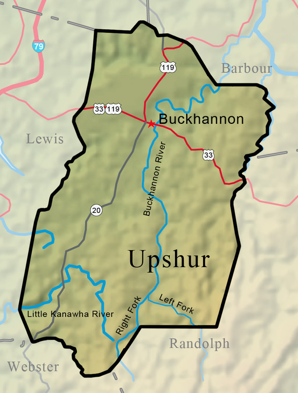


Upshur County was created on March 26, 1851, from parts of Randolph, Lewis, and Barbour counties, with Buckhannon as the county seat. Located in the north-central part of West Virginia, Upshur County is crossed by four-lane Corridor H (U.S. 33) and is within a few miles of Interstate 79. Mining, oil and gas, timbering, farming, and small industry are the major industries. The county rises from rolling foothills to mountains of more than 3,000 feet in the rugged southeastern section. The Buckhannon River is the major waterway, flowing north nearly the entire length of the county.
West Virginia Humanities Council | 1310 Kanawha Blvd E | Charleston, WV 25301 Ph. 304-346-8500 | © 2024 All Rights Reserved
About e-WV | Our Sponsors | Help & Support | Contact Us The essential guide to the Mountain State can be yours today! Click here to order.

