Note: click on the icons overlaying the map to get more details about that specific point.
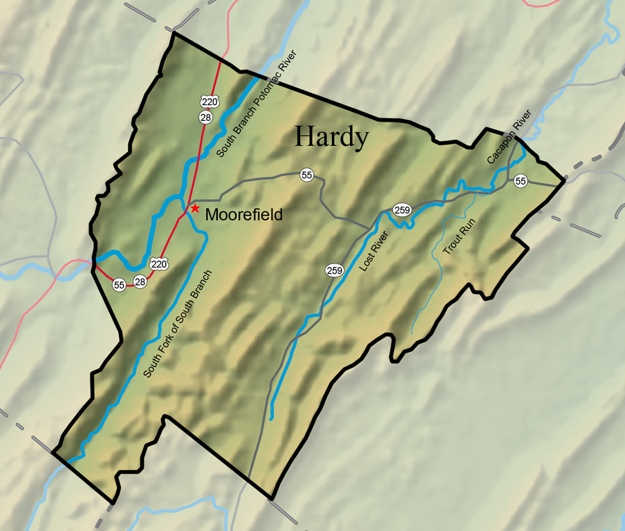


With an area of 584.6 square miles, Hardy County is divided by South Branch Mountain. Four rivers penetrate its boundaries. The rivers all flow north and eventually join the main Potomac River. Located in the Eastern Panhandle, Hardy County is bounded by Virginia on the east, Hampshire County on the north, Grant County on the west, and Pendleton County on the south.
West Virginia Humanities Council | 1310 Kanawha Blvd E | Charleston, WV 25301 Ph. 304-346-8500 | © 2024 All Rights Reserved
About e-WV | Our Sponsors | Help & Support | Contact Us The essential guide to the Mountain State can be yours today! Click here to order.

