 | Back to e-WV
| Back to e-WV
| Back to e-WV
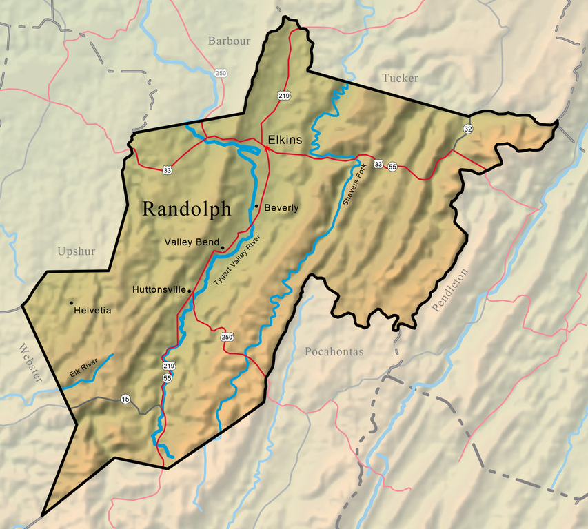


Randolph County, the largest county in West Virginia with an area of 1,040 square miles, is located at the western edge of the Potomac Highlands in east-central West Virginia. Its high, forested mountains, many of which exceed 4,000 feet, lie at the headwaters of the Cheat, Tygart Valley, Elk, and Potomac rivers.
Elkins, the county seat of Randolph County, was founded in 1889, following the extension of the West Virginia Central & Pittsburg Railroad Randolph County. The Mountain State Forest Festival is held in Elkins every year. Elkins is home to Halliehurst mansion, built in Elkins in 1890 on a 450-acre farm by Sen. Stephen B. Elkins, for whom the town is named. Davis & Elkins College was founded in Elkins in 1904. Graceland, once the summer residence of Henry Gassaway Davis, is now a country inn, operated by Davis & Elkins. The college is also the home of the Augusta Heritage Center.

Beverly, located on the Staunton-Parkersburg Turnpike, suffered much damage in the course of the Civil War, while serving as an important supply and command post for thousands of federal troops serving in eastern West Virginia.
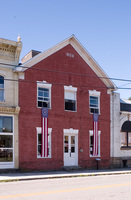
Huttonsville is home to the Huttonsville Correctional Center, a medium-security state prison.
Helvetia is a small community in the rugged southwestern corner of Randolph County, settled in 1869 by German-speaking Swiss immigrants. It was named for their native Switzerland, officially known as the Confederation of Helvetic Republics.

The Monongahela National Forest is the only national forest that is completely within the boundaries of West Virginia.
The land for Kumbrabow State Forest was purchased on December 29, 1934. The forest was named for a combination of elements of the names of Governor Kump, businessman Spates Brady, and attorney Hubert Bowers, all of whom were influential in the creation of the park.
Dolly Sods is situated on a part of the Allegheny Plateau and features flat, windswept plains and striking topography. The elevation ranges from 2,600 feet to over 4,000 feet.

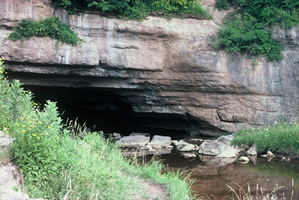
Gandy Creek sinks under the earth at a blind valley south of Yokum Knob in eastern Randolph County. The stream then flows northeast through a large cave for about three-quarters of a mile and emerges from one of the cave’s two north entrances. The Sinks may be the most visited wild cave in West Virginia.
Shavers Fork is a large tributary of the Cheat River. From its headwaters in Pocahontas County, it flows through Randolph and Tucker counties, joining the Black Fork near Parsons to form Cheat River.
The Elk River meanders 177 miles to its confluence with the Kanawha River at Charleston.
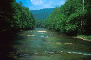
The Tygart Valley River is a major tributary of the Monongahela River. The source of the Tygart is on Valley Mountain near the Randolph-Pocahontas county line in West Virginia.
Otter Creek Wilderness Area provides recreation for hikers, campers, hunters, and cross-country skiers.

The Battle of Rich Mountain on July 11, 1861, resulted in a loss for the Confederates.
Atop Gaudineer Knob, elevation 4,450 feet, the U.S. Forest Service maintains a scenic overlook and a picnic area. About a mile away is a tract of about 50 acres of virgin spruce and associated hardwoods.

Blister Run Swamp, located within the Monongahela National Forest, was listed as a National Natural Landmark in 1974.
The Tygart Valley Homesteads was one of three resettlement projects in West Virginia intended to provide a new start for unemployed farmers, miners, and timber workers during the Great Depression.
