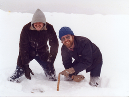
The new year of 1978 saw a widespread snow of four to ten inches across West Virginia on January 8th and 9th. During the second week of January, temperatures in the single digits and below zero followed and frequent lighter snows continued to fall into the third week of the month. This kept a snow pack of five to ten inches on the ground across the lowlands, with deeper amounts in the mountains.
On Thursday, January 19, 1978, a low pressure storm system was developing in the northeastern Gulf of Mexico near the Florida panhandle. Snow spread rapidly north, reaching southern West Virginia during the morning hours. Snow began falling across the northern counties during the early afternoon hours, reaching the far Eastern Panhandle around dark that evening.
As the storm moved northeast, milder air was forced back northwest from the Carolinas. This milder air rode over the colder air that existed near the ground in West Virginia. As a result, forecasters at the National Weather Service thought the snow would eventually mix with sleet and freezing rain. Those expectations were realized over the southern mountains and the Greenbrier Valley, including Beckley, Bluefield, and Lewisburg. This reduced the snow accumulations there. However, further west and north, the snow continued to fall. Instead of warming the temperatures aloft, that air flow enhanced the support for heavy snow over the western lowlands, with its supply of additional moisture and vertical lift.
As a result, the snow became heavier during the predawn hours of Friday, January 20th, while most West Virginians were sleeping. At the same time, the storm center was nearing the coast of North Carolina. National Weather Service personnel at Charleston observed heavy snow with visibility only a 16th of a mile at the airport.
During the daylight hours on the 20th, the storm moved north along the Mid Atlantic coast. During that afternoon, the snow diminished from southwest to northeast across the Mountain State. Lighter snow and flurries, not associated with the storm, were observed on January 21st.
A widespread accumulation of eight to 18 inches fell from the southern coalfields, northeast to include the Potomac Highlands. Snow amounts were less across those southeastern counties of the state, plus the Northern Panhandle, and the far Eastern Panhandle near Martinsburg. It was a rare snowstorm, in that more snow fell at Charleston than at Pickens in the high mountains of Randolph County. The 16.4 inches of snow accumulation at Charleston fell on top of an old snow cover of seven to eight inches. By early afternoon on the 20th, the total snow depth at Charleston averaged 24 inches. This was the deepest snow depth on record for the capital city.
Many roofs and awnings collapsed under the weight of the snow. Several buses became stranded on the hill leading to Charleston’s airport. Cities were paralyzed. Normal Friday activities were suspended.
The aftermath of the storm increased its impact on state residents. A stronger storm hit just a week later on the 26th and 27th, with barometers reaching record low pressures. The new storm was a fatal blizzard in western Ohio, Indiana and Michigan. However, in West Virginia the bulk of its precipitation fell as rain. The rain and high winds caused rapid snowmelt. Many rivers went into flood. The most serious flooding was along the Little Kanawha and Tug Fork Rivers. After the storm abated, flood waters remained as temperatures plummeted back into the single digits and teens. Despite the rain, January 1978 was the snowiest month on record for both Huntington and Charleston. Charleston measured 39.5 inches of snow, while Huntington saw 30.3 inches.
All of the snow cover was not washed away. February 1978 was extremely cold. As a result, a solid snow cover remained on the ground into early March. This period became the longest known continuous snow cover for most towns in West Virginia. Depending on location, the snow pack was on the ground for 60 to 65 consecutive days.
This Article was written by Kenneth T. Batty
Last Revised on January 31, 2022
Related Articles
Cite This Article
Batty, Kenneth T. "Snowstorm of January 1978." e-WV: The West Virginia Encyclopedia. 31 January 2022. Web. 26 July 2024.


Comments?
There aren't any comments for this article yet.
Click here to read and contribute to the discussion →