

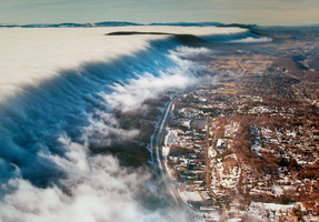
East River Mountain extends from near Tazewell, Virginia, northeastward for 35 miles to the water gap cut by the New River at the Narrows. In between, the mountain is unbroken by any deep gaps, because of the resistant Tuscarora Sandstone that forms the crest. This rock, a very hard and durable stone with a high silica content, is not easily eroded. There is a minor wind gap where State Route 598 crosses the mountain, the historic route of crooked old U.S. 52. East River Mountain forms the border of Mercer County, West Virginia, with Tazewell and Giles counties, Virginia. The big mountain posed a formidable obstacle to travel until the construction of the East River Mountain Tunnel in 1974, which now carries Interstate 77 and U.S. 52 southward to Virginia. The highest elevation along the Mercer County line is at Buckhorn Knob, 4,069 feet.
The geological structure of East River Mountain is anticlinal, that is, an upward arching of the strata. It is one of the anticlines that mark the westward edge of the Ridge and Valley Physiographic Province. Standing on the crest of East River Mountain, one may observe the parallel folds of the long, high mountains and wide valleys of the Ridge and Valley Province in Virginia to the southeast, a contrast to the Allegheny Plateau in West Virginia to the northwest, with broad, flat summits and winding streams. The base of East River Mountain in Mercer County has limestone formations, with sinkholes and caves. There are traces of minerals such as iron ore reported for locations on the mountain, but these deposits have no apparent economic value.
The East River parallels East River Mountain to the north, flowing from Bluefield across Mercer County to join the New River at Glen Lyn, Virginia.
This Article was written by Raymond Thomas Hill
Last Revised on November 21, 2023
Related Articles
Sources
West Virginia Department of Transportation. General Highway Map, Mercer County. 1992.
Cite This Article
Hill, Raymond Thomas "East River Mountain." e-WV: The West Virginia Encyclopedia. 21 November 2023. Web. 26 July 2024.

Comments?
There aren't any comments for this article yet.
Click here to read and contribute to the discussion →