 | Back to e-WV
| Back to e-WV
| Back to e-WV
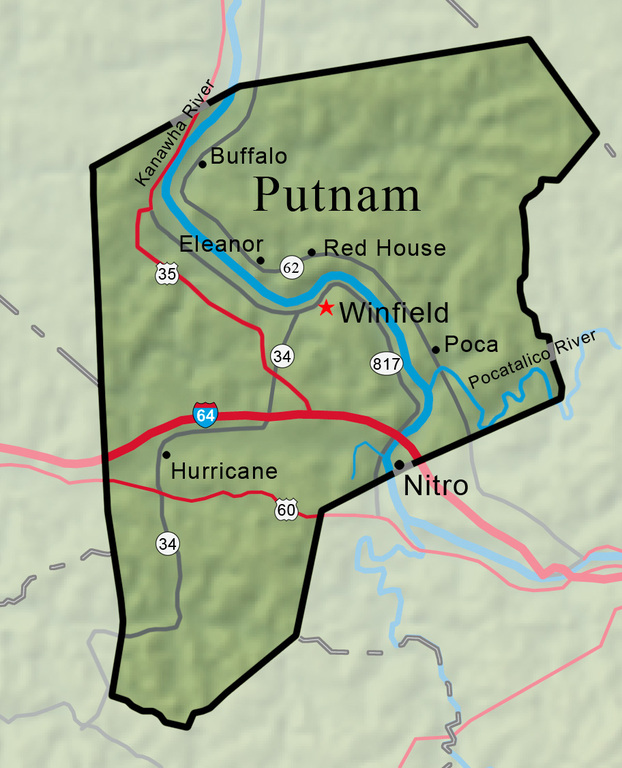


On March 11, 1848, a bill was passed by the General Assembly of Virginia to form Putnam County from portions of Kanawha, Mason, and Cabell. The new county was named in honor of Gen. Israel Putnam, who commanded the Continental Army at Bunker Hill. It straddled the Kanawha River, midway between Charleston and Point Pleasant.
Winfield was chosen as the seat of government in Putnam County because it was centrally located. Until the 1920s it was still the smallest county seat in the state and the only one without a paved road or a railroad leading to it. The town depended on river travel.
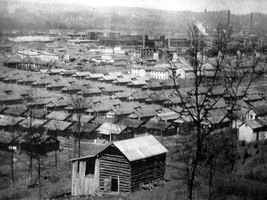
The town of Nitro was built during World War I to manufacture munitions. The town is located in both Putnam and Kanawha counties.
Hurricane, which was incorporated in 1888, has become a center of Putnam County’s growing suburban community.
Buffalo is home to a Toyota plant, built in 1997. The Buffalo archeological site is located near the town. It encompasses at least four time periods in one Late Archaic village (4000–1000 B.C.), one Middle Woodland village (A.D. 390–530), and at least two overlapping Fort Ancient villages (A.D. 1300–1600). The town was once home to the Buffalo Academy, which drew students from up and down the Ohio and Kanawha valleys.
Now a residential community, Eleanor began as a government attempt to help victims of the Great Depression. The town was named for Eleanor Roosevelt.
The Red House Shoal is located on the Kanawha River near the town of Red House in Putnam County. A rock ledge in the river with nearly a three-foot drop, the shoal was a serious obstacle to navigation before the river was dammed and its depth increased.
Poca was a trade and shipping center for Poca River farmers until after the Civil War. Many Raymond City miners preferred to live in Poca. In 1895, a timber company began extensive operations on the waters of Pocatalico, which added to Poca’s growth.
Scary Creek was the site of one of the earliest battles of the Civil War and one of the first Confederate victories.
Before the first lock system was completed in 1898, the Kanawha River had 10 separate rapids or shoals between Charleston and Point Pleasant. They were all well-known to river men but still caused numerous wrecks, often resulting in the loss of lives and cargoes.
The Pocatalico River passes in a southwestward direction through Roane, Kanawha, and Putnam counties. Its watershed includes the southern corner of Jackson County, as well. The length of the Pocatalico is 67.7 miles, and its course is very crooked.