| Back to e-WV
| Back to e-WV
| Back to e-WV


The Virginia General Assembly established Preston County on January 19, 1818, taking the land from Monongalia County. The new county was named for James Patton Preston, then governor of Virginia. Already, the Indians had retreated, forts Morris and Butler were no longer in use, the American Revolution and the War of 1812 were past, and the settlers could devote themselves to improving the quality of their lives.
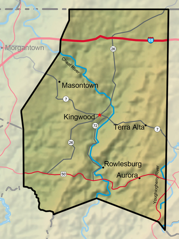
Kingwood is the county seat of Preston County. Overlooking the Cheat River Valley at an elevation of 1,862 feet, Kingwood was settled in 1807 and chartered by the Virginia legislature in 1853. It was named for a grove of tall, stately trees. It is the site of the annual Buckwheat Festival.
The persistent wind from the northwest during the winter of 1976–77 led to several snowfalls and West Virginia’s coldest month on record, January 1977. Terra Alta in Preston County measured 104 inches of snowfall that month, a state record.
At Rowlesburg, Preston County, a lumber depot built at the junction of the Baltimore & Ohio Railroad and the Cheat River served as a destination of many rafts steered down the Cheat River.
Photographer Volkmar Wentzel completed high school in Aurora, Preston County. Wentzel was a writer and photographer for National Geographic (1937–85), and one of the magazine’s most-traveled senior staffers
The Youghiogheny River, a major tributary of the Monongahela River, originates in Preston County at an elevation of nearly 2,500 feet.
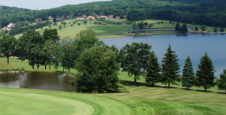
The Alpine Lake Resort and Conference Center started as a hunting and fishing camp in the 1930s.
Arthurdale was the first of many experimental communities founded under the National Industrial Recovery Act of 1933.
Hopemont was West Virginia’s first tuberculosis sanitarium.

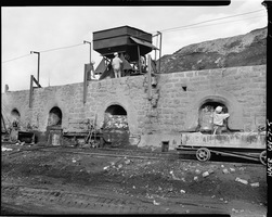
The Bretz coke ovens were the last beehive coke ovens to operate in West Virginia.
Camp Dawson is the West Virginia Army National Guard’s primary training site in West Virginia.

The Kingwood Tunnel was constructed on the Baltimore & Ohio Railroad between 1849 and 1852 near Tunnelton. The tunnel’s completion allowed the completion of the B&O across Western Virginia to Wheeling.
The Etam Earth Station is one of the major sites in the country for receiving transmissions from orbiting communications satellites.

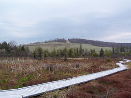
Cranesville Swamp is located in Preston County, West Virginia, and Garrett County, Maryland. The swamp totals nearly more than 1,600 acres.
Masontown had a population of 546 in 2010.
The Cheat River drains about 1,420 square miles in northern West Virginia. It flows free, untamed, and without dams from its headwaters to Cheat Lake, a few miles above the river’s mouth.
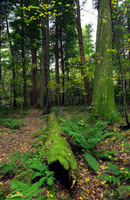
Cathedral State Park has the only stand of virgin hemlock remaining in West Virginia.
The Tray Run Viaduct was one of the most impressive early-19th-century railroad bridges in the nation and among the first modern iron railroad bridges in the United States.
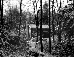
Youghiogheny Forest Colony, a historic artists colony, originally consisted of 12 log cabins.