 | Back to e-WV
| Back to e-WV
| Back to e-WV


Pocahontas County is the third largest county in West Virginia, with 941.6 square miles, but among the least populous, with a 2010 population of 8,719. Eight rivers have their headwaters in the county. Elevations range from slightly under 2,000 feet to several points above 4,800 feet. Located mostly within the upper Greenbrier Valley, Pocahontas County is underlain by sandstone, shale, and limestone.
Marlinton, the county seat of Pocahontas County, developed quickly after the Chesapeake & Ohio Railway constructed its line up the Greenbrier River about 1900. The Marlinton Opera House (now known as the Pocahontas County Opera House) was built in 1910.
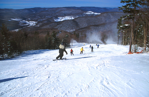
Durbin was built to support the booming timber business in the early 20th century. Visitors to the town can ride the Durbin Rocket, an excursion train powered by a steam locomotive.
The National Youth Science Camp is located near Bartow, within the boundaries of the Monongahela National Forest.
Green Bank is home to the National Radio Astronomy Observatory, which provides access to its research equipment to scientists from all over the world. The National Radio Astronomy Observatory is home to the historic Reber Radio Telescope, the first telescope built specifically for picking up radio waves from outer space.

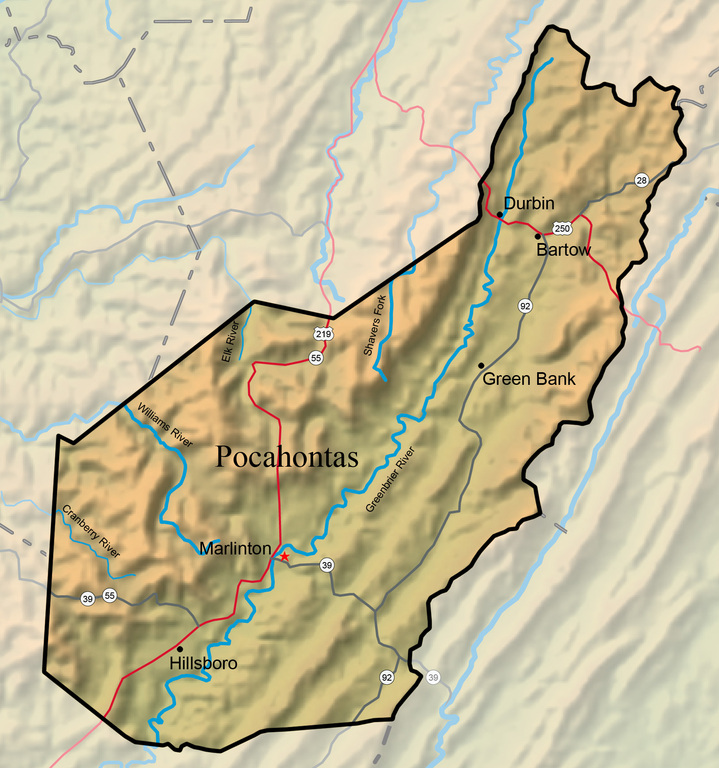
Pearl Buck, the first American woman to receive the Nobel Prize for Literature, was born in Hillsboro, in the home of her maternal grandparents. This house is now the Pearl S. Buck Birthplace Museum.
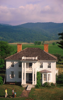
Snowshoe Mountain Resort is West Virginia’s largest ski resort. The 251-acre, 60-slope complex rests on top of Cheat Mountain, with elevations as high as 4,848 feet.
The Cass Scenic Railroad, the major attraction at the Cass Scenic Railroad State Park, offers excursion rides on a historic logging railroad line.
Beartown, a 107-acre state park, is one of the state’s most unusual natural areas, Beartown is a world of stone, with rocks the size of houses and deep crevices the size of streets twisting among the rocks. A half-mile boardwalk on stilts allows visitors to view the spectacular sight.
On November 6, 1863, Droop Mountain was the site of one of the most important Civil War battles fought on West Virginia soil. Confederate troops led by Brig. Gen. John Echols were defeated by a larger federal force led by Brig. Gen. William W. Averell. West Virginia dedicated Droop Mountain Battlefield State Park, now 287 acres, on July 4, 1928.

The Williams River rises in Pocahontas County at an elevation of almost 4,000 feet.
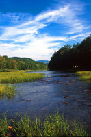
The Elk River meanders 177 miles from its headwaters in Pocahontas County westerly to its confluence with the Kanawha River at Charleston.
Shavers Fork is a large tributary of the Cheat River. From its headwaters in Pocahontas County, it flows through Randolph and Tucker counties, joining the Black Fork near Parsons to form Cheat River.
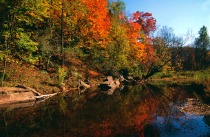
The Greenbrier River rises in two forks in the high mountains at the northern end of Pocahontas County, at elevations exceeding 3,600 feet.
Minnehaha Springs was once the site of a popular resort and hunting lodge called Allegheny Lodge.
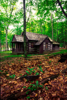
Seneca State Forest is the oldest unit in the state park and forest system.
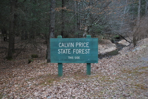
Calvin W. Price State Forest is the newest of West Virginia’s nine state forests. Covering 10,800 acres on the east side of the Greenbrier River, the forest is named in honor of one of Pocahontas County’s best-known residents, Calvin W. Price (1880–1957).
The largest of West Virginia’s state parks, at 10,100 acres, Watoga is also among the oldest, dating back to the first land acquisitions by the West Virginia Game and Fish Commission in the 1920s.
The Cranberry Glades occupy a high valley hemmed in by Cranberry Mountain on the east and south, Kennison Mountain on the west, and Black Mountain to the north.
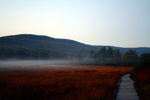
The Cranberry River flows through the heart of the remote Cranberry backcountry of Greenbrier, Webster, and Pocahontas counties.
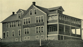
Denmar was once home to the West Virginia State Colored Tuberculosis Sanitarium, known as Denmar Hospital.
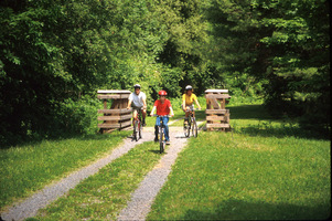
The Greenbrier River Trail follows the old Greenbrier Division of the Chesapeake & Ohio Railway along the Greenbrier River, traveling from Cass in Pocahontas County to Caldwell, near Lewisburg.
The Monongahela National Forest is the only national forest that is completely within the boundaries of West Virginia.
Atop Gaudineer Knob, elevation 4,450 feet, the U.S. Forest Service maintains a scenic overlook and a picnic area. About a mile away is a tract of about 50 acres of virgin spruce and associated hardwoods.

The Friars Hole Cave is the longest cave in West Virginia, with eight entrances and 44 miles of surveyed passage.
Beginning at Richwood and extending to a point near Marlinton, the Highland Scenic Highway provides access to the high mountains at the headwaters of the Cranberry and Williams rivers.