 | Back to e-WV
| Back to e-WV
| Back to e-WV
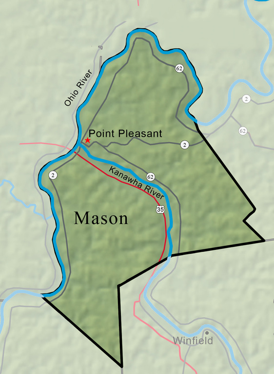


Mason County, created on January 2, 1804, from part of Kanawha County, is named for the statesman George Mason. The Ohio River forms the western boundary, and the Kanawha River divides the northern and southern parts of the county. Mason has long been a leading agricultural county, producing milk and livestock, corn, hay, tobacco, and orchard fruit.
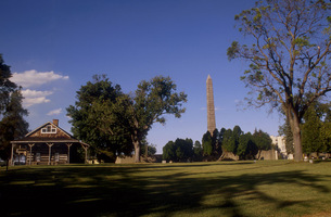
Point Pleasant, the county seat of Mason County, was chartered in 1794 by the General Assembly of Virginia. Point Pleasant was the site of the Battle of Point Pleasant in 1774. Fort Randolph, one of the most important military outposts of the Trans-Allegheny frontier, was located on the north bank of the Kanawha River at its mouth, at Point Pleasant.
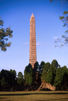
Tu-Endie-Wei is the point of land that overlooks the confluence of the Ohio and Kanawha rivers. It is home to the Point Pleasant Battlefield Monument State Park.
The Ohio River begins at Pittsburgh, with the union of the Allegheny and Monongahela rivers. From there the Ohio travels 981 miles to Cairo, Illinois, where it joins the Mississippi.
Before the first lock system was completed in 1898, the Kanawha River had 10 separate rapids or shoals between Charleston and Point Pleasant.
The West Virginia State Farm Museum, located on State Route 62 four miles north of Point Pleasant, is a replica of an early rural community.
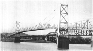
On Friday, December 15, 1967, at about 5 p.m., the bridge spanning the Ohio River at Point Pleasant collapsed, sending cars plunging into the Ohio River. There was a total of 46 fatalities, including five killed on the Ohio shore.
Lakin Correctional Facility is the only all-female prison prison in the state.