 | Back to e-WV
| Back to e-WV
| Back to e-WV
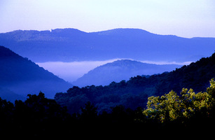
The Appalachian Mountains extend from Alabama to Newfoundland, and westward from the Piedmont to the Midwest. Elevations range as high as 6,684 feet in North Carolina, 5,729 feet in Virginia, and 4,861 feet in West Virginia. The Alleghenies, one of the constituent ranges making up the Appalachians, traverse West Virginia, as does a short section of the Blue Ridge. West Virginia is the only state located wholly within the Appalachian Mountains.
In the Paleozoic Era, a mountainous land mass of old, strong, and highly complex rock was situated along the Atlantic Coast. The region is referred to as “Old Appalachia” and included the area that became the modern Blue Ridge and Piedmont. About 275 million years ago, in a mountain-building event known as the Appalachian Orogeny, the sediments produced by the erosion of Old Appalachia were raised from the bottom of an inland sea and produced the ‘‘Young Appalachians.’’
The Young Appalachians were worn down by stream erosion to a nearly level plain in the Mesozoic Era. At the close of the era, the Appalachians were again uplifted and many rivers, especially the New River, became entrenched. Since that time stream erosion has created in the east the present mountainous landscape of parallel ridges and valleys and in the west a dissected plateau where streams follow the slope in a dendritic or tree-like pattern. The mixture of youthful valleys and mature intervening high ground produces a difficult terrain, with 90 percent of West Virginia in slopes of more than 10 percent grade.
The last cataclysmic event to affect the Appalachian Mountains were glaciers in the great Ice Age. Glaciers did not extend into West Virginia, but when they blocked the northern outlets of the ancient Teays and Monongahela rivers the modern Ohio River was created. It became the major drainage system for the central Appalachian Mountains, including most of our state.
The major physiographic divisions of the Appalachian Mountains in West Virginia are (from east to west) the Blue Ridge, Ridge and Valley, and Allegheny Plateau. Between the Ridge and Valley and the Allegheny Plateau is the Allegheny Front, and between the Allegheny Front and the Allegheny Plateau in north central West Virginia are the rugged Allegheny Mountains. Near two-thirds of the state is within the Allegheny Plateau, lying to the west of the Allegheny Mountains, with another fifth within the Ridge and Valley.
West Virginia’s climate and weather are affected by the lay of the land, with an average elevation of 1,500 feet and heights that extend upward to a maximum of 4,861 feet at Spruce Knob. Cold to mild winters and hot to cool summers prevail, with a mean annual temperature between 50 and 55 degrees. The average annual precipitation of about 43 to 45 inches is about evenly distributed throughout the year, though with considerable geographical variation. For example, Pickens receives an average of about 70 inches and Brandywine about 30 inches of precipitation yearly.
The mountainous terrain, mid-latitude location, and ample rainfall support a varied forest vegetation cover. About 80 percent of the state is covered with regrowth mixed hardwoods that include oak, hickory, poplar, maple, sycamore, cherry, and black walnut. The softwoods include spruce and white and Virginia pines. Some of America’s best hardwood sawtimber is produced in the counties of the Allegheny Front, Allegheny Mountains, and Allegheny Plateau.
The Appalachian Mountains are not endowed with prime farm land. In West Virginia, the best agricultural land is in the Eastern Panhandle and Ohio River valley counties. Three-fourths of the market value of agriculture is concentrated in the Ridge and Valley, primarily in poultry, livestock, hay, and corn production. Tobacco is a specialty crop produced in several southwestern counties.
Topography affects the distribution of people in the Appalachian Mountains. In West Virginia, the population of about 1.8 million resides mostly in counties along the Ohio, Kanawha, New, and Monongahela rivers, and in the Eastern Panhandle in Berkeley and Jefferson counties. By census definition the state’s population is predominantly rural with about two-thirds living outside urban and metropolitan places. The average density is 77 people per square mile, while that of surrounding states is several times greater.
Written by Howard G. Adkins
Fenneman, Nevin M. Physiography of Eastern U.S.. New York: McGraw-Hill, 1938.
Hunt, Charles B. Physiography of the U.S. San Francisco: W. H. Freeman & Co., 1967.
Janssen, Raymond E. Earth Science: A Handbook on the Geology of West Virginia. Clarksburg: Educational Marketers, 1973.